Territories of Memory: How African and African American Cartographers Mapped the World Before It Was Taken From Them
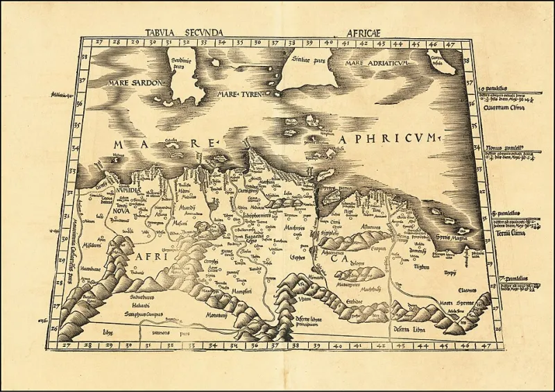
Photo: Martin Waldseemüller, Public domain, via Wikimedia Commons
A map is never merely a diagram. It is an argument—a claim about who belongs where, who holds authority over a given landscape, and whose knowledge of that landscape counts as legitimate. The history of Western cartography, presented in most American classrooms as a progressive accumulation of geographic understanding, is also a history of erasure: the systematic displacement of African spatial knowledge by colonial institutions that needed terra incognita not because the land was unknown, but because acknowledging who knew it would have complicated the legal and moral architecture of dispossession.
This erasure was not passive. It was methodical, professionally organized, and written into the conventions of cartographic practice itself. Understanding it requires looking beyond the maps that survived—the ones housed in European archives and celebrated in art history surveys—and recovering what those maps replaced.
The Cartographic Traditions of Pre-Colonial Africa
Long before Portuguese caravels traced the West African coastline, and centuries before European geographers debated the sources of the Nile, African societies had developed sophisticated systems for encoding geographic knowledge. These systems were not always expressed in the two-dimensional, north-oriented format that Western cartography normalized. They were embedded in oral traditions, architectural orientations, trade route mnemonics, textile patterns, and ceremonial objects—formats that colonial scholars, trained to recognize only one mode of geographic representation, consistently failed to identify as cartographic.
The Mali Empire, at its fourteenth-century apex, administered a territory larger than Western Europe. Its commercial infrastructure—the trans-Saharan trade routes linking Timbuktu to Cairo, to Tunis, to the Mediterranean ports—required sophisticated geographic knowledge that was maintained and transmitted by a professional class of merchants, scholars, and navigators. The libraries of Timbuktu, whose manuscript collections have been partially preserved and are now the subject of intensive scholarly recovery efforts, contained geographic texts that documented trade routes, river systems, and territorial boundaries with a precision that challenges the myth of African geographic ignorance.
Further east, the Swahili coast cities—Kilwa, Mombasa, Malindi—were integrated into Indian Ocean navigational networks whose geographic knowledge was encoded in piloting manuals, star charts, and seasonal wind calendars. The Arab geographer al-Idrisi, whose twelfth-century world map remains one of the most frequently reproduced documents in the history of cartography, drew extensively on the geographic testimony of East African informants whose names his text records but whose intellectual contributions Western historiography has consistently attributed to his synthesis rather than their knowledge.
The Moors, the Maghreb, and the Mapping of the Medieval World
Among the most consequential and least acknowledged contributors to the geographic knowledge that underpinned European exploration were North African and sub-Saharan scholars operating within Islamic intellectual networks. Al-Idrisi himself, born in Ceuta and educated in Córdoba, produced his Tabula Rogeriana for the Norman king Roger II of Sicily—a map that represented the most accurate geographic synthesis of its era and drew on African geographic traditions that had been accumulating for centuries.
Leo Africanus, the Andalusian-born Moroccan diplomat and scholar whose Description of Africa, written in the early sixteenth century, became the primary European reference for African geography for more than a hundred years, is a particularly instructive case. His text, composed in Italian for a European audience after his capture by Spanish pirates and subsequent life at the Vatican, was received as a European scholarly achievement. The African geographic knowledge it encoded—gathered through years of travel across the Sahara, the Sahel, and the West African kingdoms—was treated as raw material rather than intellectual product. Leo Africanus was transformed, in European reception, from a sophisticated African geographer into a useful native informant.
This pattern—African geographic knowledge appropriated, laundered through European authorship, and returned to the world as European discovery—is not an exception in the history of cartography. It is one of its organizing principles.
Post-Emancipation Black Surveyors and the Politics of Land
In the American context, the cartographic erasure of Black geographic knowledge took on a specifically economic dimension during and after Reconstruction. The promise of land redistribution—encapsulated in the phrase "forty acres and a mule" and briefly instantiated in Special Field Orders No. 15, issued by General William T. Sherman in January 1865—required geographic knowledge. Land had to be surveyed, parceled, and legally described before it could be transferred. The Black surveyors who participated in this process, working within the Bureau of Refugees, Freedmen, and Abandoned Lands and in independent professional capacities, were performing work of enormous political consequence.
When Reconstruction collapsed and the land redistribution program was systematically reversed, the geographic knowledge those surveyors had produced did not simply disappear. It was archived selectively, with Black-authored surveys either suppressed, attributed to white supervisors, or preserved in federal records in ways that obscured their origins. The communities that had participated in those surveys, however, retained their own geographic memory—knowledge of boundaries, of water access, of timber rights, encoded in community oral tradition and occasionally in locally maintained documents that have only recently begun to receive scholarly attention.
The legal consequences of this erasure have been devastating and long-lasting. The loss of Black land ownership in the American South—estimated by scholars such as Daina Ramey Berry and others to represent one of the largest transfers of wealth in American history—was facilitated in part by the destruction or suppression of Black-generated geographic documentation. Without maps, without surveys, without legally recognized geographic records, communities could not defend territorial claims in courts that were, in any case, structurally hostile to Black plaintiffs.
Reclaiming Geographic Memory
The recovery of African and African American cartographic traditions is not merely an academic exercise. It has direct implications for ongoing land rights struggles, for the repatriation of cultural knowledge, and for the way American communities understand their own geographic histories. Organizations working at the intersection of Black land rights and historical documentation—including the Federation of Southern Cooperatives and various community land trust networks—are increasingly incorporating historical cartographic research into their advocacy work, using recovered geographic knowledge to support legal claims and community organizing.
At the scholarly level, historians of cartography such as Matthew Edney and critical geographers working within the tradition established by J.B. Harley have developed theoretical frameworks for analyzing maps as political documents. Applying those frameworks to African and African American cartographic traditions requires not only archival recovery but a fundamental reconsideration of what counts as a map—and whose knowledge of the land counts as authoritative.
The territories that African cartographers charted, that Saharan navigators memorized in starlight and sand, that Black surveyors measured in the brief window of Reconstruction's promise—those territories still exist. The communities that remember them still exist. What has been systematically dismantled is the documentary record that would allow those memories to function as legal and political instruments.
Reclaiming that record is, at its core, a project of historical justice. It begins with the recognition that the blank spaces on European maps were never empty. They were full of people who already knew exactly where they were.